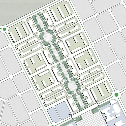
MELİKGAZİ DISTRICT NAZIM BEY NEIGHBORHOOD URBAN SETTLEMENT AREA 1/5000 SCALE CONSERVATION REVISION MASTER ZONING PLAN AND 1/1000 SCALE CONSERVATION REVISION IMPLEMENTARY DEVELOPMENT PLAN
Kayseri Urban Settlement Area, located South of the city center and separated by the Inonu Street, is loaded with intense trade and service functions. The area covers approximetely nine hectares and hosts various historical, cultural and architectural identity features. The texture of the streets and building plots, as well as the existing civil architecture in the area, clearly emphasizes the importance of the traditional historical settlement. Reasonably, the structural and urban texture patterns of the area demonstrates its importance to regain to the urban environment. In this context, planning decisions aim to preserve and maintain the original structure of the area in accordance to the conducted analytical studies. The primary objectives for the revision development plan conduct conservation planning solutions.
As not used recently, the planning work aims to integrate and renew the site, which has a unique character in the region, to the urban contiguous area as a sub-region within new zoning terms and incentive functions of the Urban Protected Area.